Site movement strategy
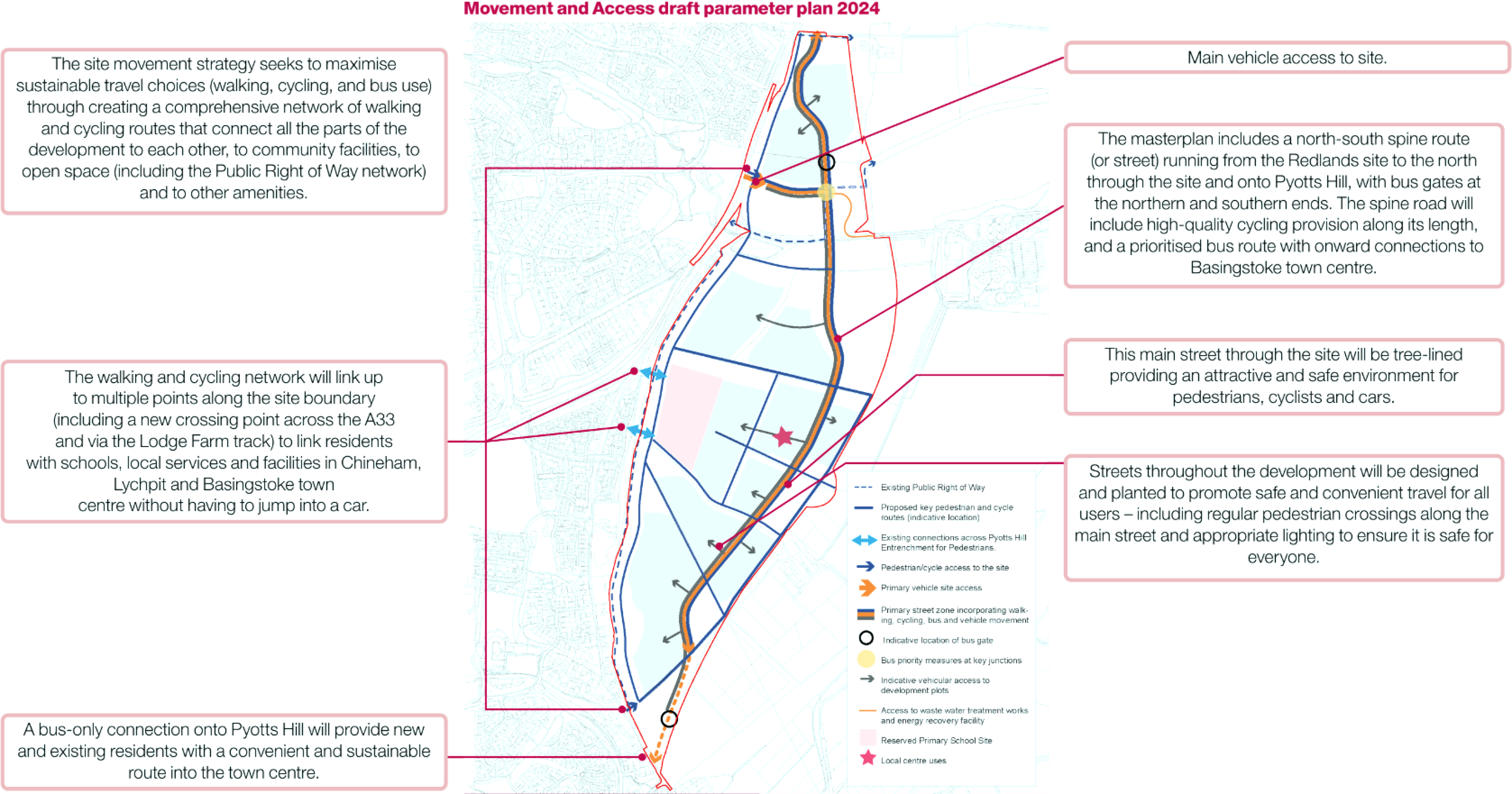
Wider links and connections:
- The site is well connected by foot and cycle to destinations in Chineham and Lychpit, including the National Cycle Route 23. This is routed near the south-western edge of the site along Pyotts Hill, connecting Basingstoke town centre to Bramley, and beyond to Reading.
- On the north part of the site new walking and cycling routes will tie into the Redlands site, creating a continuous route along the western boundary of the site up to Taylors Farm Roundabout.
- The Public Rights of Way (PRoW) network within the site will be enhanced and new connected routes will provide good access to the surrounding countryside and existing PRoWs.
- The proposed bus route through the site may be an extension of an existing bus route linking to the Town Centre and Sherfield Park, but may also be a new service that serves development sites to the north of the site (such as at Redlands) as well as under-served communities between the site and Basingstoke town centre. This is under development.
- Discussions with the highways authority are ongoing and through this work any requirements for this site to contribute towards improvements to ease traffic congestion on the A33 will be agreed.
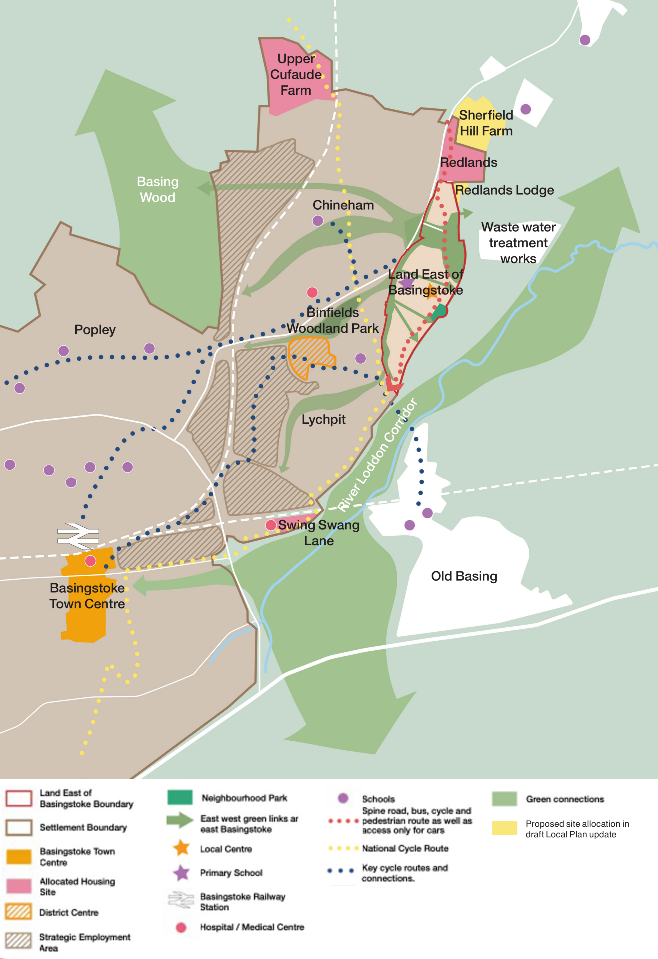
This plan shows Land East of Basingstoke in the context of the wider north-east of the town, and how it would connect to existing and future new communities.
The next section explains our more detailed work on access to the site:
- A main junction off the A33 for vehicles,
- Access from the north for buses, other vehicles, pedestrians and cyclists
- Access from the south off Pyotts Hill, for buses only. Pedestrians and cyclists coming from the south will access from the existing farm track to Lodge Farm.
New A33 access junction
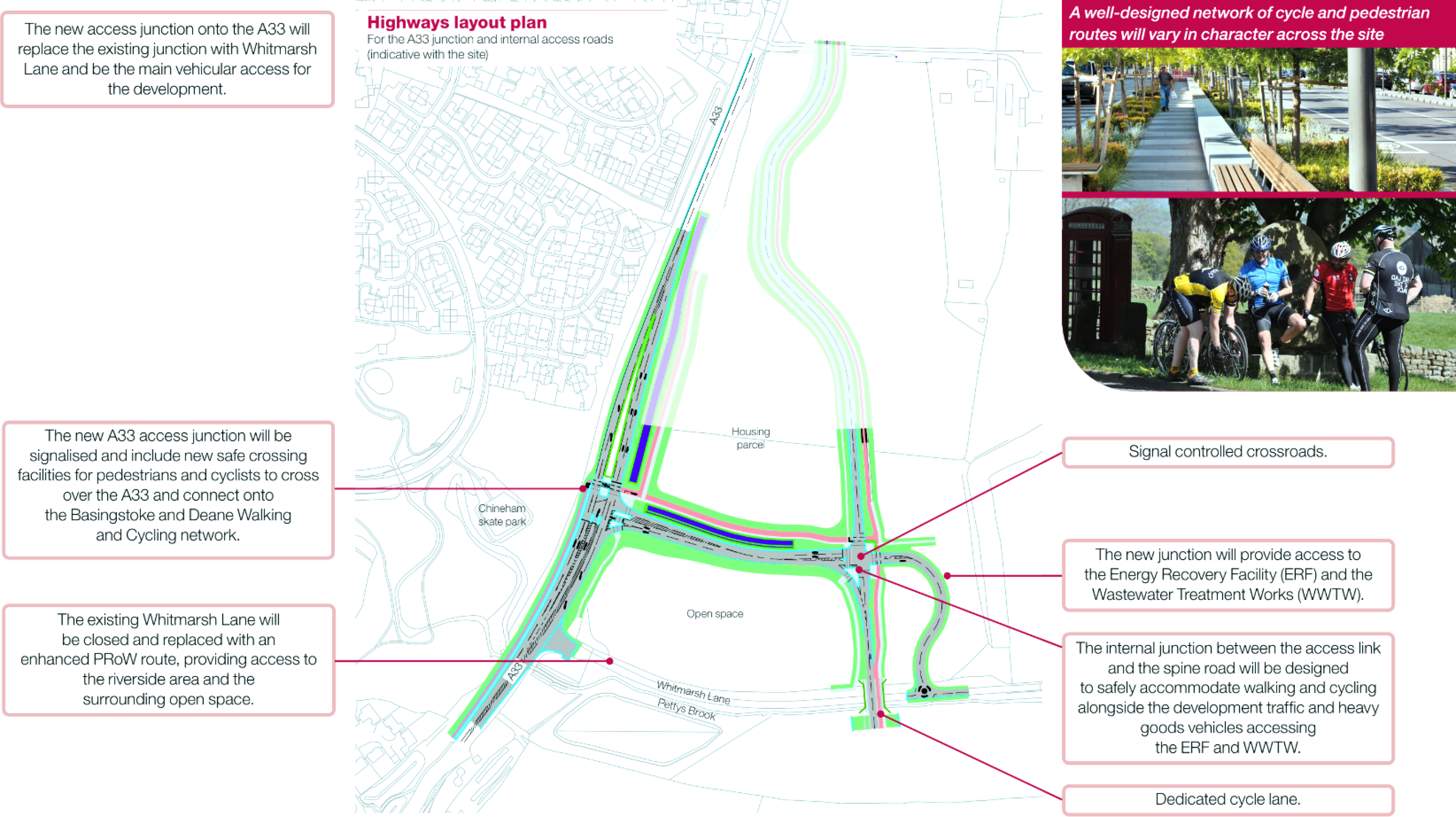
Redlands: link to the north of the site
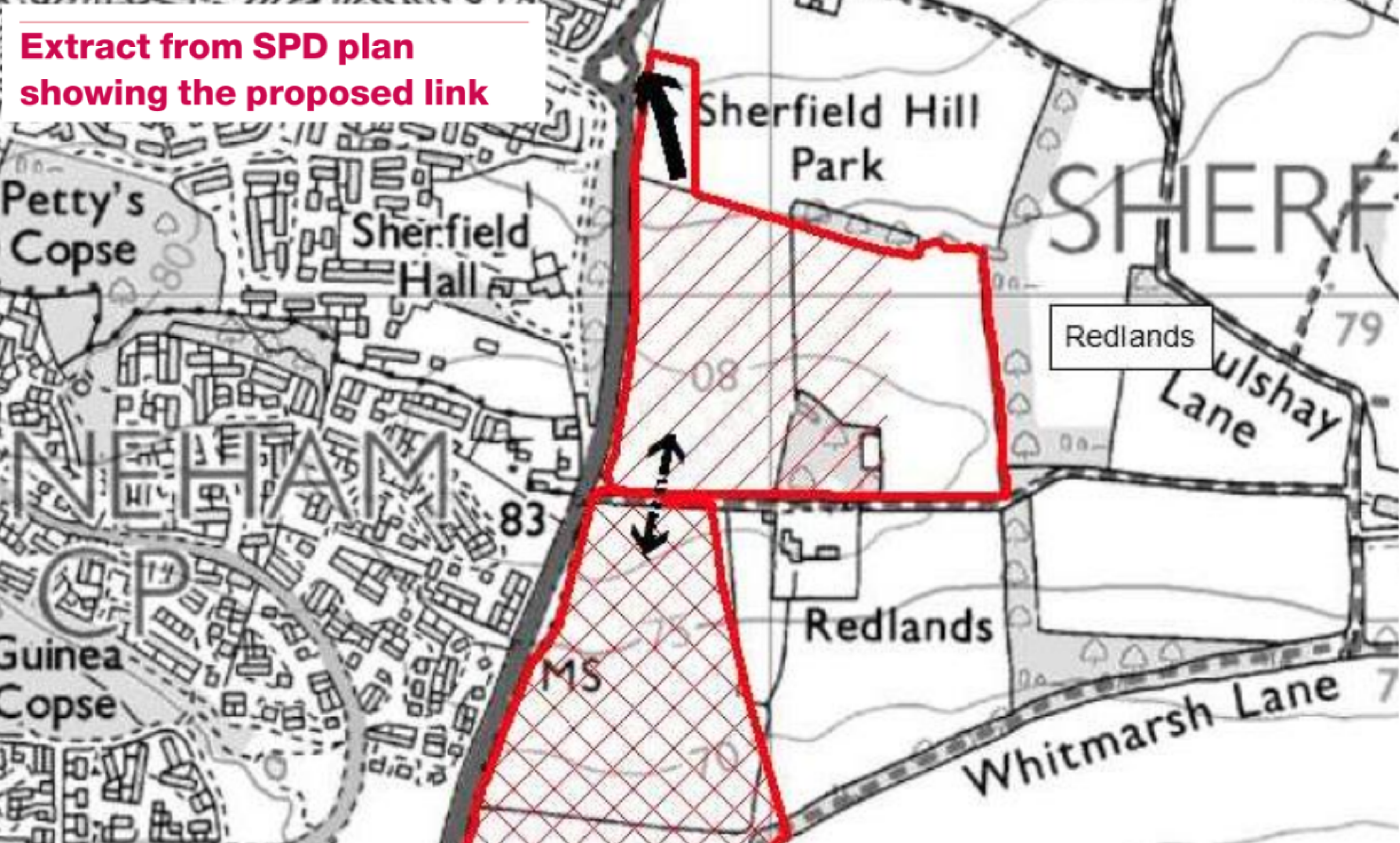
- The north-south spine road serving the new development will link directly into the Redlands site, and onwards to the Taylors Farm Roundabout on the A33.
- A bus gate will be included in the northern parcel of the site to prevent traffic “rat-running” through it, while providing a direct route for future bus services.
- The new connection into the Redlands site will include walking and cycling facilities and supports a connection to the existing Public Right of Way along Redlands Lane (running along the northern boundary of the site).
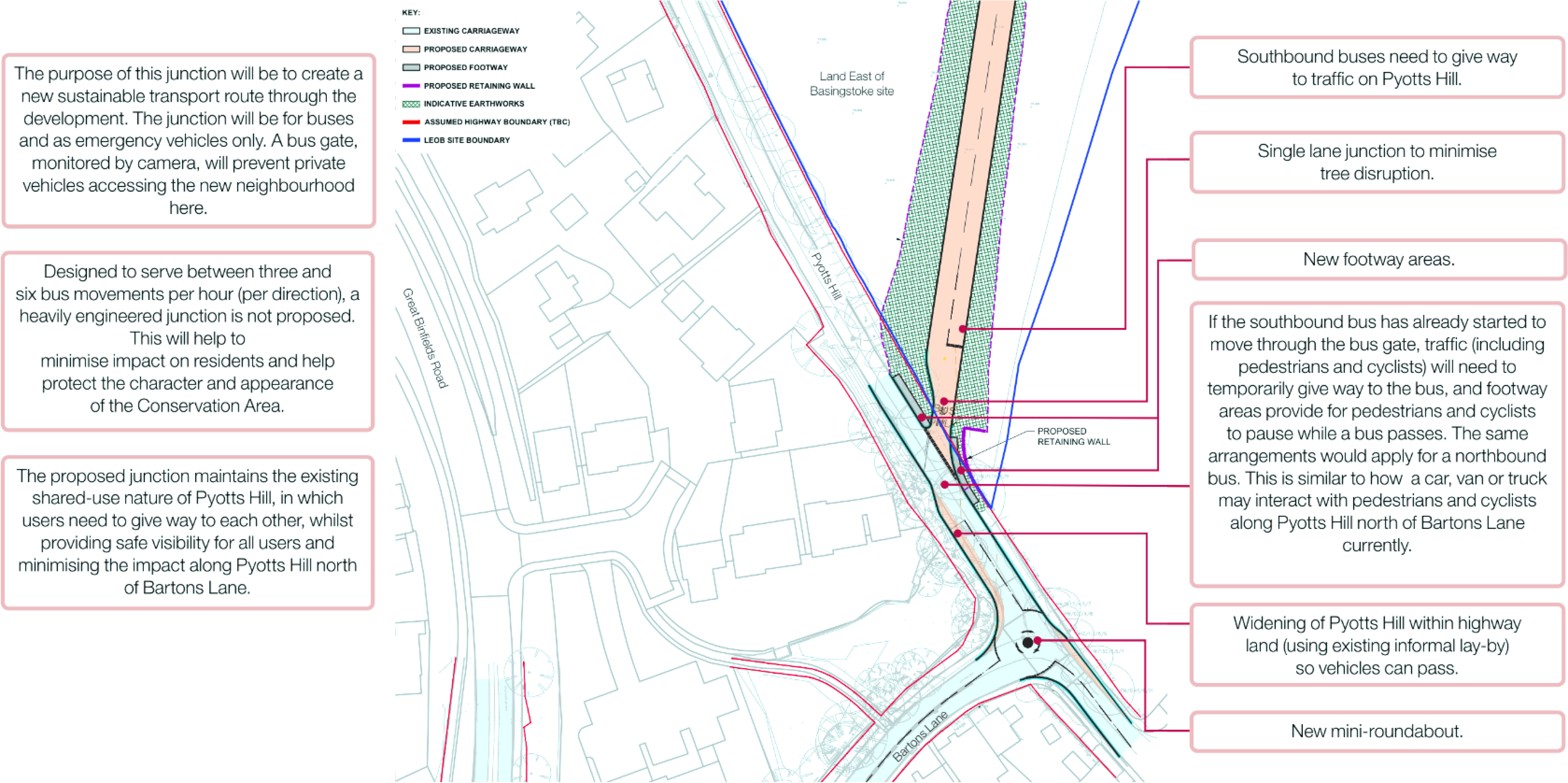
This section explains our more detailed work on proposals for the Pyotts Hill junction and illustrates how buses, as well as pedestrians and cyclists, and cars travelling to existing properties could safely continue to move on Pyotts Hill.
Pyotts Hill junction:
This plan shows the current junction design for a connection from the site onto Pyotts Hill for buses only. Buses would then use Bartons Lane to access Great Binfields Road.
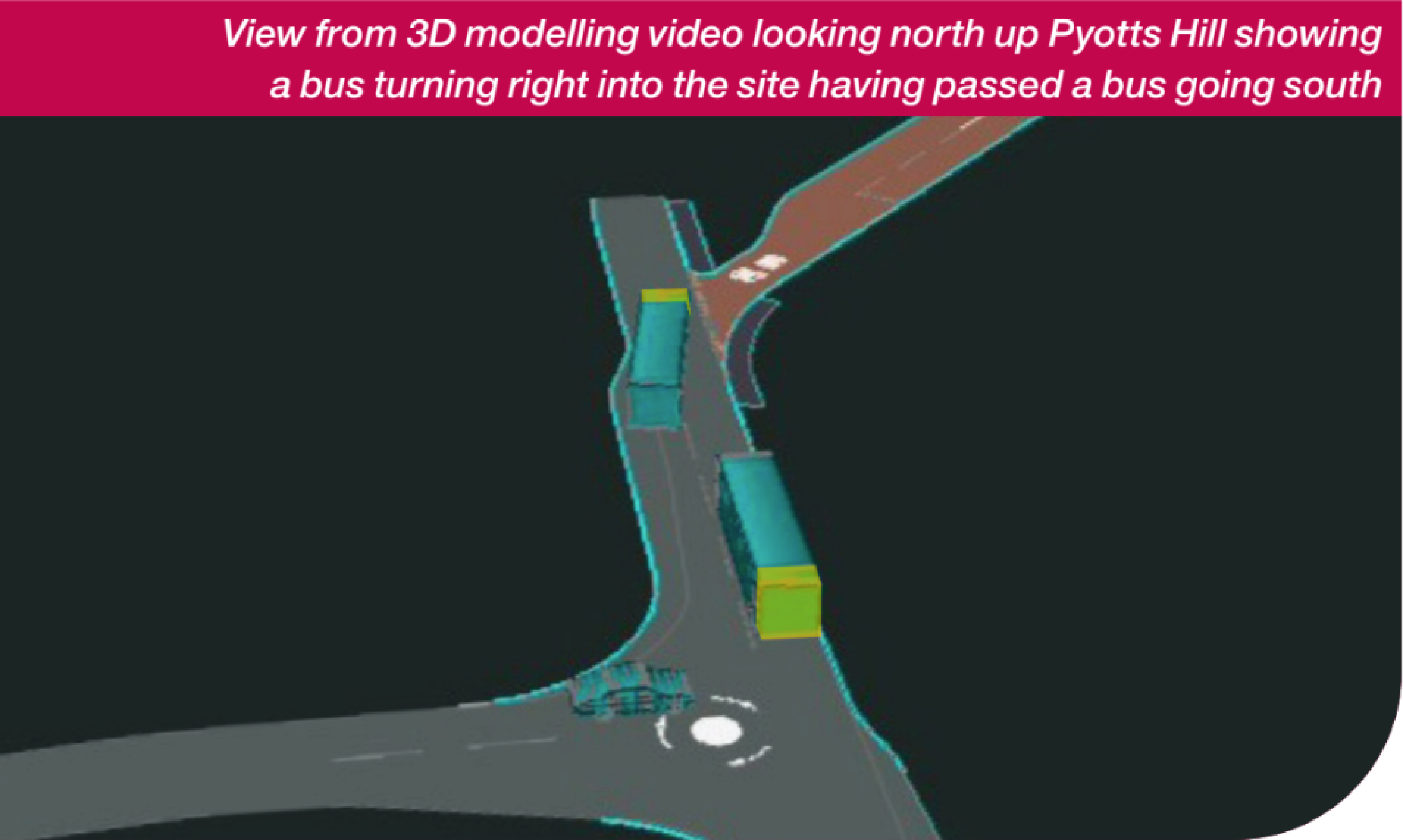
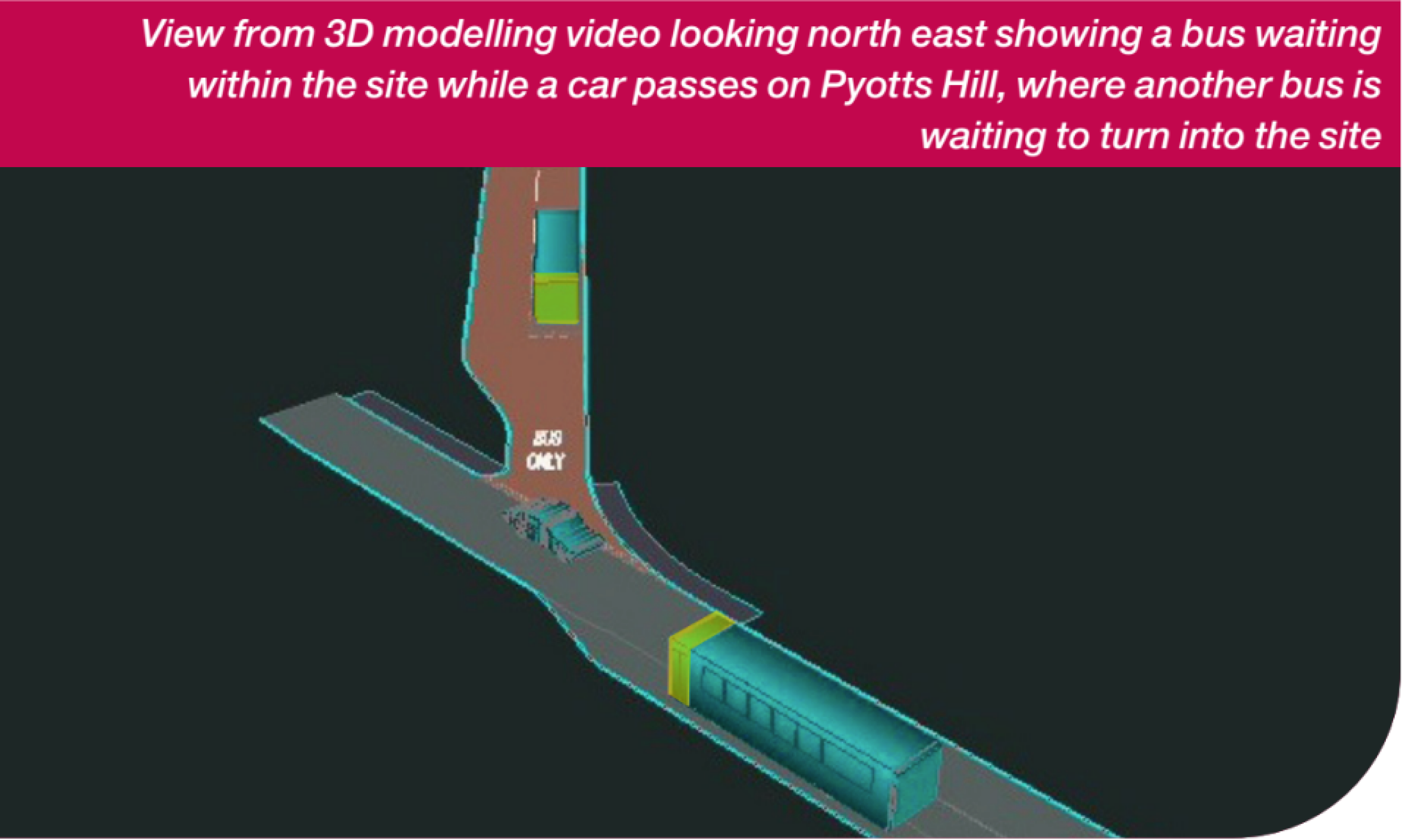
3D modelling video illustrating the proposed junction design and the movement of buses and cars through Pyotts Hill and Bartons Lane. The proposal is for Pyotts Hill to remain a shared use environment (as it is currently) and the videos show how vehicles can safely pass each other along the bottom section of Pyotts Hill.
Pyotts Hill junction sketch view
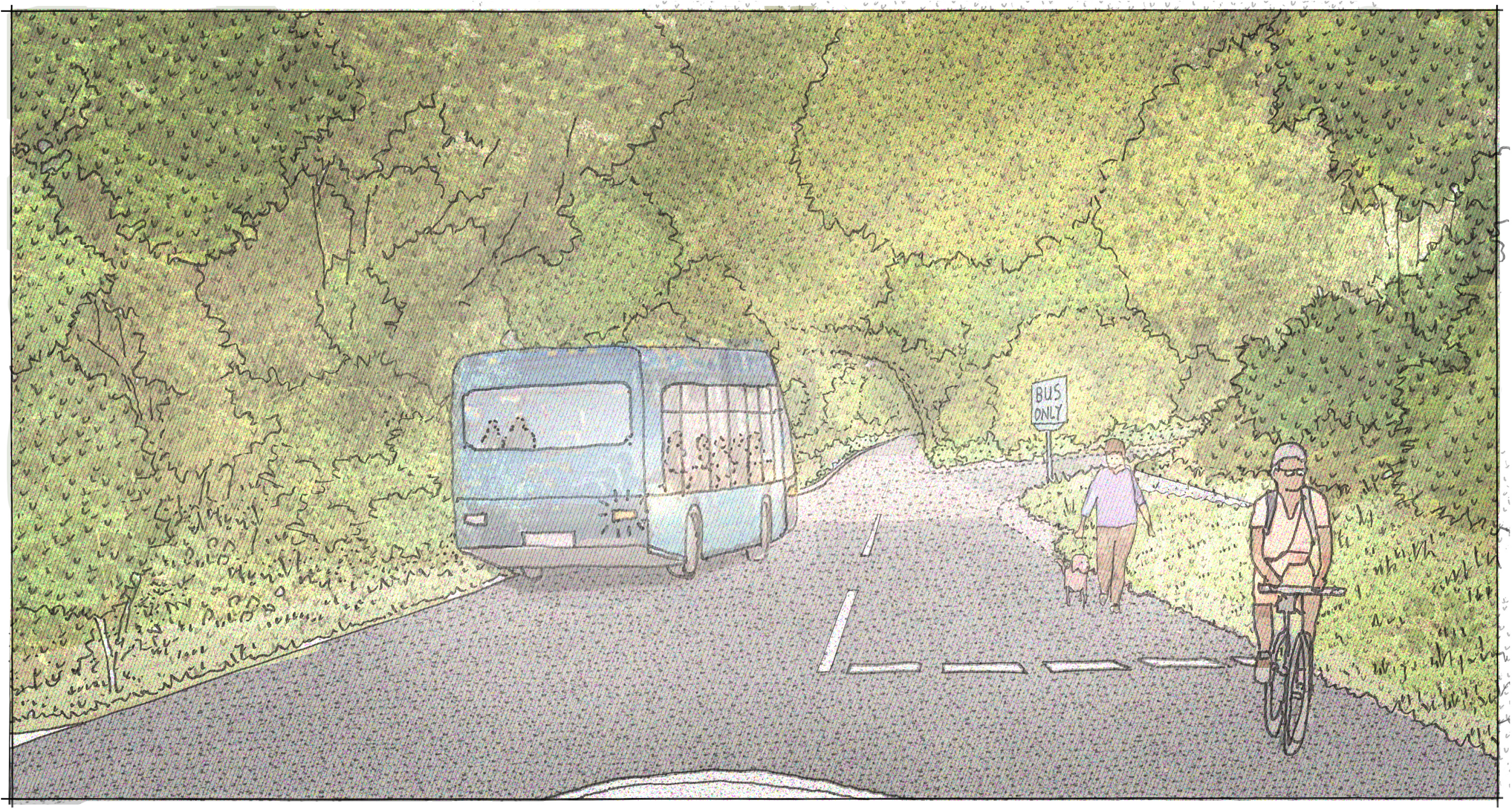
This illustration shows a sketch view of the junction looking north up Pyotts Hill, and illustrates how different users such as walkers and cyclists could continue to be able to use the lane safely as well as buses.